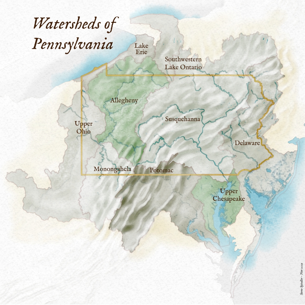
Pennsylvania’s watersheds extend in many directions
This morning I started out by watching a few Pennsylvania DEP YouTube videos about water quality and Active Mine Drainage facilities. They are well done and interesting. The DEP’s work is essential.
I decided to create a watershed map of Pennsylvania. Maybe it would be useful. This is what I came up with. I think it could have gone in many directions.
One thing is that the Allegheny and Monongahela Rivers run into the Ohio and head to the Gulf of Mexico. Also the Genesee River starts in Pennsylvania and heads north to Lake Ontario.
The Susquehanna, with two branches, starts in both Pennsylvania and New York. And the Delaware starts in New York and captures water from four states.
The map does simplify things a bit, but I worked with it enough and wanted to post it today.

The primary data that I referenced was The National Map, and I used HU-4 watershed subregions. I suppose there’s more that could have been done with it. Like better river coverage for some rivers, better differentiation of the wetlands, and labeling the Great Lakes and Atlantic. And I could have worked with the colors a little more.


