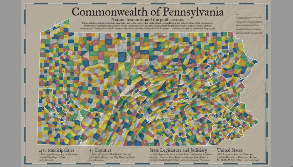
A map of Pennsylvania
Today I was collating data so that I can make more Congressional District Maps. I recently met with Dr. David Cuff, who had created and edited several atlases. And I was very pleased with the way some maps turned out of District 4 Congressional District in Pennsylvania.
So, I made this map. I\’m not going to write a lot, but it illustrates how much effort it can take to govern a state with so many municipalities. I\’ll make other maps of Pennsylvania, but I would love to see maps that others might make.
Download QGIS and some data from PASDA or TIGER. Have fun, and ask me if you need help.
Here\’s a PDF of the map: Pennsylvania Municipalities_sm
I definitely have to brighten this up.


